


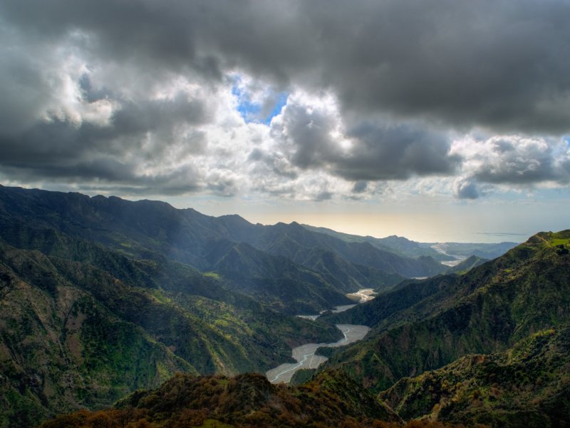
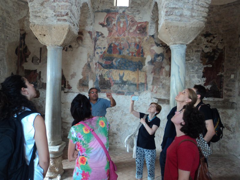
A day in the Chòra
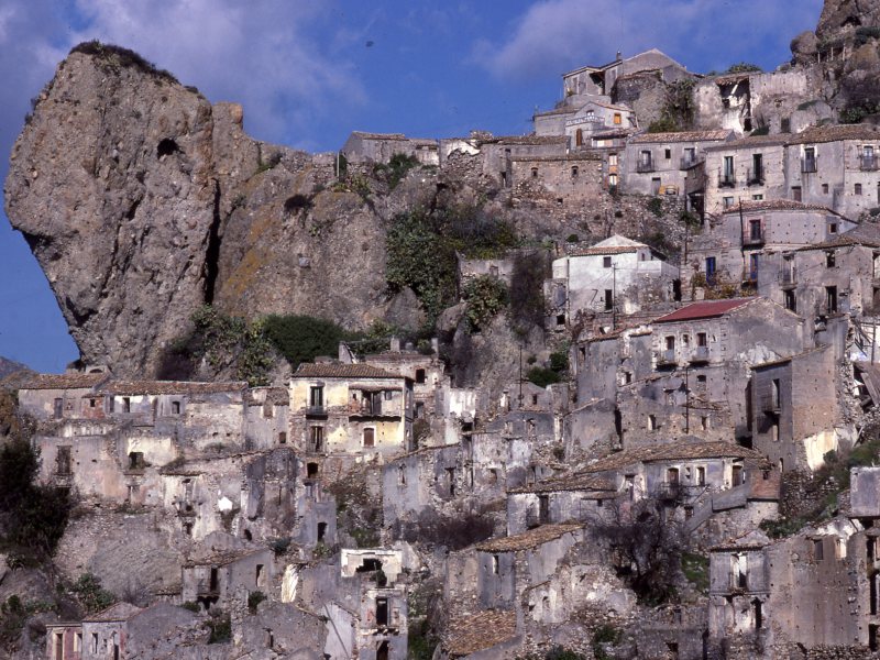
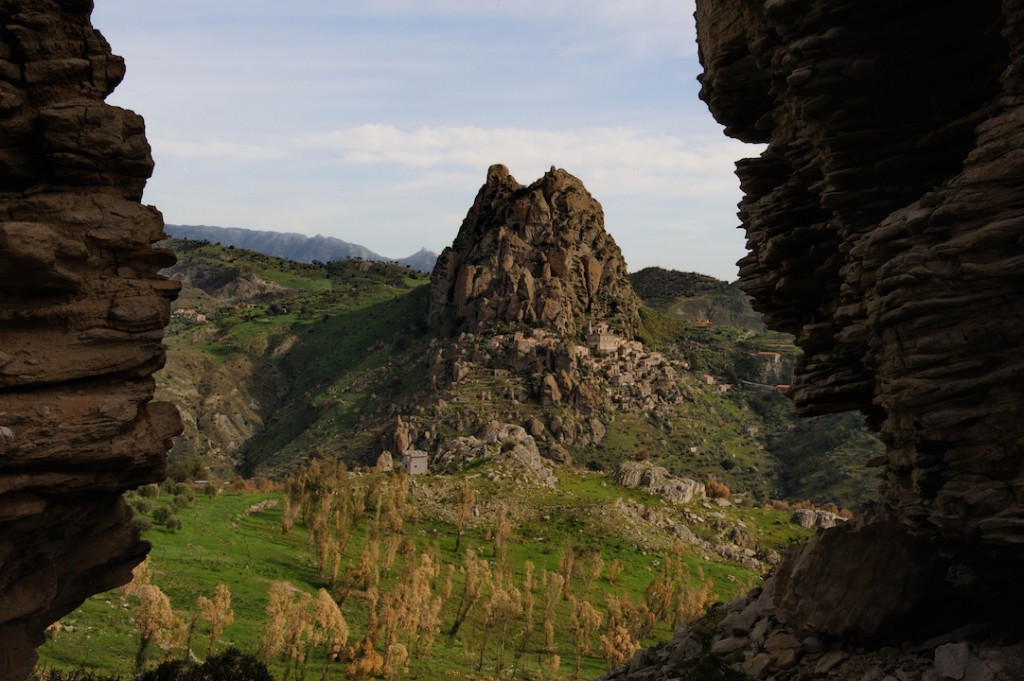
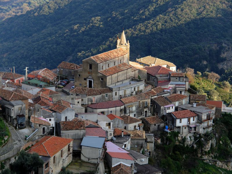
BovaFalcon’s nest, lofty height which only the good walker can reach, dream of a legendary builder who

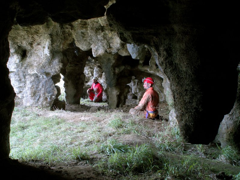
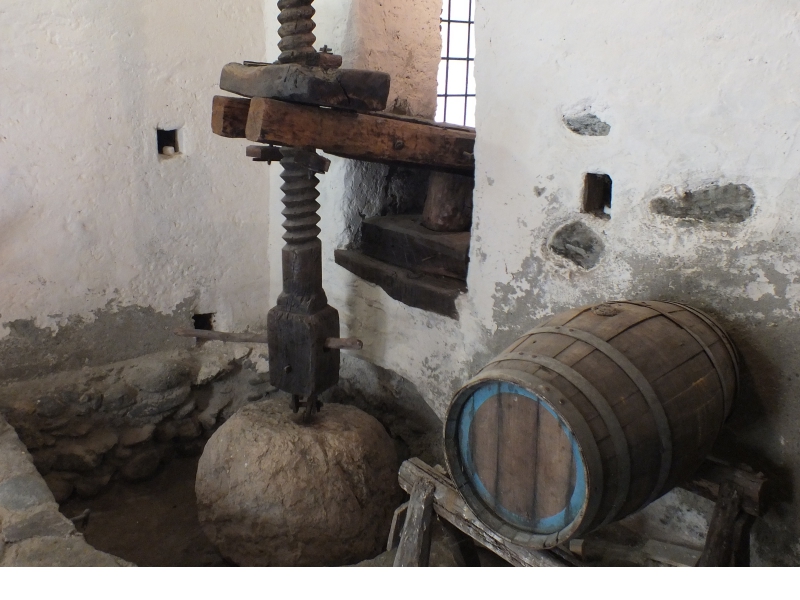
A visit to the Archeoderi archaeological site and its treasures
Bova MarinaThe San Pasquale site bears witness to the fact that this area has been inhabited since the Neolithi
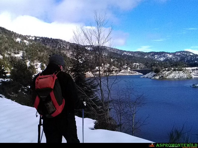
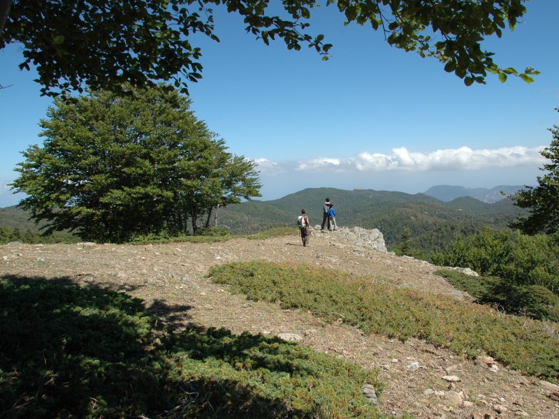
Cross-country skiing around the Menta Lake
Roccaforte del GrecoTechnical data
Sport: cross country skiing
Difficulty: easy
Periodo: February
Municipality: Roccafor

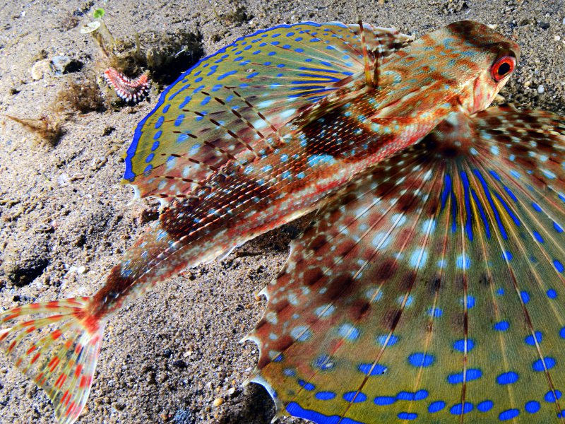
DIVING at Capo San Giovanni
Bova MarinaCapo San Giovanni at Bova Marina
The story of an underwater itinerary by Francesco Turano, written e
DIVING at Lazzaro and Capo dell'Armi
Motta San GiovanniLazzaro and Capo dell’Armi
The story of an underwater itinerary by Francesco Turano, written espec

ECOLOGICAL TOURISM. La Calce di San Giovanni
Montebello JonicoTechnical data
A circular trekking route amid the Fossato Hills, touching on interesting historical-

ECOLOGICAL TOURISM. The wild-boar hunters’ trail
Montebello JonicoA circular trekking route amid the Fossato Hills, touching on interesting historical-cultural sites

EXCURSION Condofuri - Monte Scafi - Gallicianò
CondofuriTechnical data
Municipality: Condofuri
Difficulty: EE
Elevation difference: 749 metres
Altitudes and

EXCURSION from Amendolea Nuova to Amendolea Vecchia
CondofuriTechnical data
Municipality: Condofuri
Difficulty: T
Elevation difference: 217 metres
Elevation: Ame

EXCURSION from Bova to Monte Grosso
BovaTechnical data
Municipality: Bova
Difficulty: E
Elevation difference: 531 metres roughly uphill
Alti
EXCURSION from Bova to Roghudi
BovaTechnical data
Municipality: Bova
Difficulty: E
Elevation difference: 467 metres downhill, 160 metre
EXCURSION from Gallicianò to Grecia
CondofuriTechnical data
Municipality: Condofuri
Difficulty: T
Elevation difference: 200 m circa
Altitude: gat
EXCURSION from Ghorio di Roccaforte to Vallone Colella
Roccaforte del GrecoTechnical data
Municipality: Roccaforte del Greco
Difficulty: EE
Elevation difference: about 220 met

EXCURSION from Ghorio di Roghudi to Pesdavoli
RoghudiTechnical data
Municipality: Roghudi
Difficulty: EE
Elevation difference: 876 metres
Altitude: Ghori
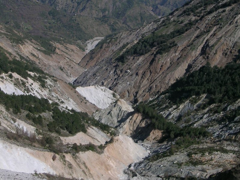
EXCURSION from Misurici to the Colella landslide and Punta d’Atò
Roccaforte del GrecoTechnical data
Municipality: Roccaforte
Difficulty: T
Elevation difference: 398 metres
Altitude: Mis

EXCURSION from Pietrapennata to Madonna dell’Alica
PalizziTechnical data
Municipality: Palizzi
Difficulty: T
Elevation difference: irrelevant
Altitude: Pietra

EXCURSION from Sella Entrata to Motticella
CardetoTechnical data
Municipality: Cardeto
Difficulty: T
Time required: 1.30 hours
Drinking water: Founta

EXCURSION from Staiti to Monte Cerasia
StaitiTechnical data
Municipality: Staiti
Difficulty: T
Elevation difference: 464 m
Altitude: Staiti (549
EXCURSION from Tefani to Focolio
CondofuriTechnical data
Municipality: Condofuri
Difficulty: T
Elevation difference: 390 m
Altitude and partia
EXCURSION to Monte di Fossato
Montebello JonicoTechnical data
Municipality: Montebello Jonico
Difficulty: E
Time: 5 – 6 hours
Drinking water: Fos
EXCURSION to Pentedattilo
Borgo di PentedattiloTechnical data
Municipality: Melito di Porto Salvo
Difficulty: T
Elevation difference: negligible
Al

EXCURSION to San Pantaleone
San LorenzoTechnical data
Municipality: San Lorenzo
Difficulty: T
Elevation difference: irrelevant
Altitude: 60

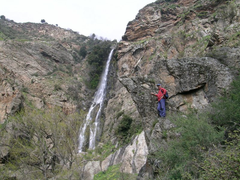
EXCURSION to the Amendolea Falls
RoghudiTechnical data
Municipalities: Roccaforte del Greco, Roghudi (but Gambarie is the closest village)
D
EXCURSION to the Ferraina Forest
RoghudiTechnical data
Municipalities: Roccaforte del Greco, Roghudi, Samo (although the closest village is

EXCURSION to the Fossato Valley
Montebello JonicoTechnical data
Municipality: Montebello Jonico
Difficulty: T
Time: 4 hours
Drinking water: Fossato,
EXCURSION to the little church of S.Niceto
Bova MarinaTechnical data
Municipality: Bova Marina
Difficulty: E
Elevation difference: negligible
Altitude: ro

EXCURSION to the Marafia Falls
San LorenzoTechnical data
Municipality: San Lorenzo
Difficulty: E
Altitude: Croce di San Lorenzo 665 metres abo

EXCURSION to the Melito River’s Upper Valley
BagaladiTechnical data
Comuni: Bagaladi, ST Lorenzo
Difficulty: E
Elevation difference: there is no signific
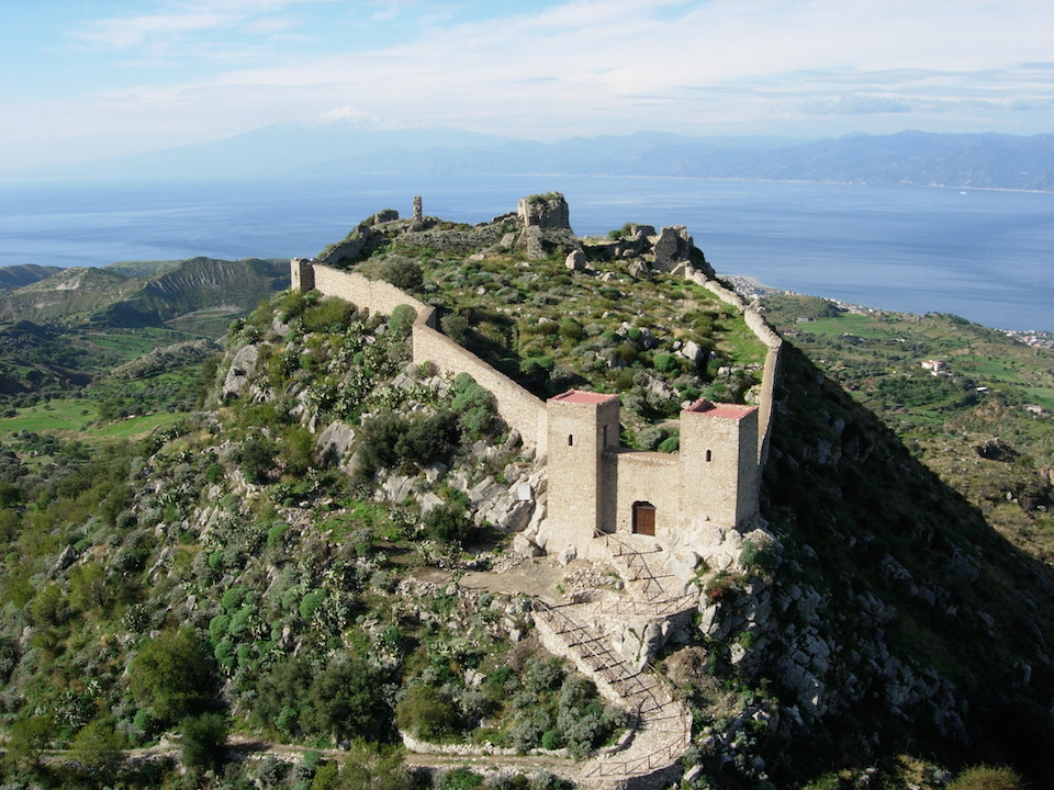
EXCURSION to the S. Niceto Castle
Motta San GiovanniTechnical data
Municipality: Motta San Giovanni
Difficulty: T
Time required: 1.40 hours
Drinking wat

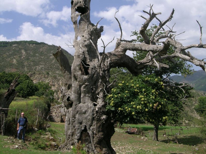
EXCURSION to the Sanctuary of Santa Maria di Mallamace
CardetoThe Greek-Orthodox rite was observed in Cardeto and the Sant’Agata river valley until 1700. During
EXCURSION: Lamia's Cave
Montebello JonicoGrotta della Lamia [Lamia’s Cave] is the most important and extensive natural underground formatio

EXCURSION: the Montalto Ring
CardetoTechnical data
Municipalities: a number of municipalities share slivers of Montalto but Gambarie is
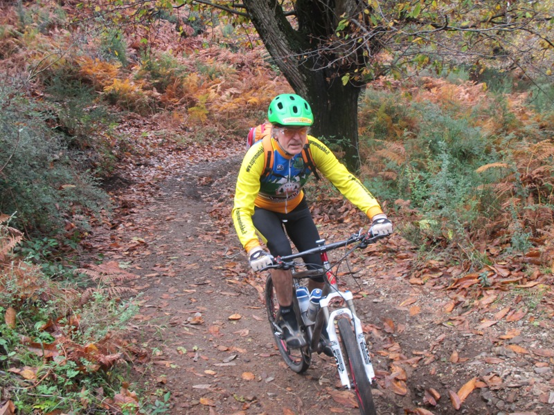
MOUNTAIN BIKING from Valanidi to Sant'Agata
Montebello JonicoTechnical data
Municipalities: Montebello Jonico, Reggio Calabria
Difficulty: MC/BC (uphill MC: f

MOUNTAIN BIKING in the Amendolea Valley
Calabria GrecaTechnical data
Municipalities: Roccaforte del Greco, Roghudi
Difficulty: MC/BC (uphill MC: for touri
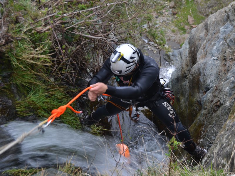
RAFTING in the Marte–Gigliola Gorge
BovaTechnical data
Difficulty: easy
Season: October – May
Municipality: Bova
Locality: Timone – Ma

RAFTING on the Furria Torrent
RoghudiTechnical data
Difficulty: easy
Season: from April to November
Municipality: Roghudi
Locality: Camma

ROCK CLIMBING at Carmine
PalizziTechnical data
Difficulty: easy
Period: all year round
Municipality: Palizzi
Location: Carmine
Contr

ROCK CLIMBING at Rocca di Sant’ Ippolito
PalizziTechnical data
Difficulty: medium
Period: from September to May
Municipality: Palizzi
Locality: S. I

San Lorenzo. The Barbarians are back
San LorenzoThe Barbarians are back
At San Lorenzo the quest for past memories continues
11th. June: presentati

SNOW TREKKING from Tre Limiti to Nardello
Roccaforte del GrecoTechnical data
Sport: snow-shoe trekking (but also cross-country skiing)
Difficulty: medium
Season:
The Byzantine Trail
Montebello JonicoTechnical data
Length: 5.5-6.00 Kilometres
Difficulty: Medium
Time: 3.5/4.0 hours
Route
Meeting poin

The waterway: from the sea to the river in search of truth
Calabria GrecaKnowing how to listen is a condition which is necessary so that the territory may reveal itself to t
To Domadi Greko
Calabria GrecaTO DOMADI GREKO
Get to know the language to get to know the territory
The Greek-speaking Jalò tu V
TREKKING from Amendolea to Bova
BovaFrom Amendolea a Bova
Itinerary
This itinerary, which follows a track recently plotted by the Reggio

TREKKING from Amendolea to Gallicianò
Borgo di Galliciano'From Amendolea to Gallicianò
Itinerary – Outward route
You leave from the Il Bergamotto rural h

TREKKING from Bagaladi to Amendolea
Borgo di AmendoleaFrom Bagaladi to Amendolea
Itinerary
We leave early in the morning from Bagaladi and make our way
TREKKING from Bova to Palizzi Superiore
Borgo di Palizzi SuperioreFrom Bova to Palizzi Superiore
Itinerary
“No wilder, nor more extraordinary place than Palizzi

TREKKING from Bova to Roghudi Vecchio
Roghudi VecchioFrom Bova to Roghudi Vecchio
Itinerary
The itinerary follows one of the oldest pathways linking Bov
TREKKING from Montebello to Pentedattilo
Montebello JonicoFrom Prastarà di Masella to Pentedattilo
Itinerary
This itinerary is simple and wends its way th

TREKKING from Pentedattilo to Bagaladi
BagaladiFrom Pentedattilo to Bagaladi
Itinerary
We leave the enchanted hamlet of Pentedattilo from the litt
TREKKING from Pietrapennata to Staiti
Borgo di PietrapennataFrom Pietrapennata to Staiti
Itinerary
From the small main square of the hamlet of Pietrapennata (
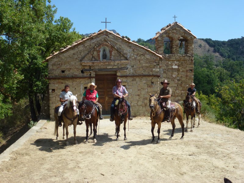
TREKKING ON HORSEBACK from Campolico to Ghorio di Roghudi
RoghudiTechnical data
Municipalities: Sant’Agata del Bianco, Samo, Africo, Roghudi
Difficulty: ER (exper

TREKKING ON HORSEBACK from Ghorio di Roghudi to Gambarie
CardetoTechnical data
Municipalities: Roghudi, Roccaforte del Greco, San Lorenzo, Bagaladi, Cardeto, Reggi